Beyond Urban–Rural Binaries: Remote Sensing Indicators of Built Environment Risk for Firearm Injury in Cook County, Illinois
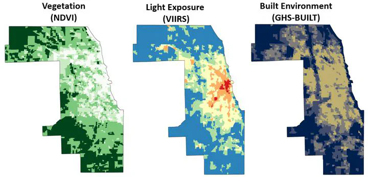
Presented at the 2025 National Research Conference for the Prevention of Firearm-Related Harms, this study develops a remote-sensing–based framework to identify built environment risk factors for firearm injury in Cook County, Illinois. Using satellite-derived indicators of nighttime light intensity, impervious surface coverage, vegetation (NDVI), and built-up density merged with firearm injury data from 2020–2024, we fit spatial random forest models and Bayesian spatial Poisson models to quantify environmental predictors of firearm harm.
Findings show that built environment characteristics—rather than traditional urban–rural categories—more accurately distinguish high-risk census tracts. High built-up intensity, fragmented greenness, and asymmetric nighttime activity remain strong predictors even after accounting for area-level deprivation. These results demonstrate the utility of remote sensing for identifying structural vulnerability and guiding place-based firearm injury prevention.
📄 Presentation
Download the presentation here .

Dr. Gia Elise Barboza-Salerno
Director
I am an interdisciplinary scholar whose research integrates law, public health, social work, and advanced statistics to study childhood adversity, violence-related harm, and neighborhood-level inequities. I lead the ISSUES Lab at Ohio State, translating spatial and legal analysis into policy and practice.